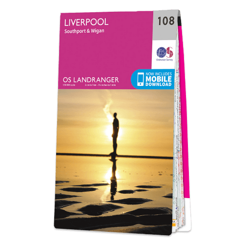
OS Landranger - 108 - Liverpool, Southport & Wigan
1:50,000 scale
2 cm to 1 km or 1¼ inches to 1 mile
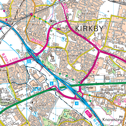
The OS Landranger Map is the ideal map for planning the perfect day out. Whether visiting town or country, a wealth of visitor attractions, including National Trust properties, museums, gardens, golf courses and castles, are illustrated. The 1:50k scale mapping provides an ideal compromise between detail and coverage whilst still retaining topographical and contour properties.
OS Landranger map features include:
• Roads, railways and ferry routes
• Paths, national trails and cycle routes
• National Trust areas
• Forestry Commission land
• National Parks
• Tourist information and places of interest
• Camping and caravan sites
• Picnic areas and viewpoints
• Rights-of-way information for England and Wales.
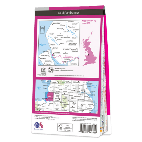
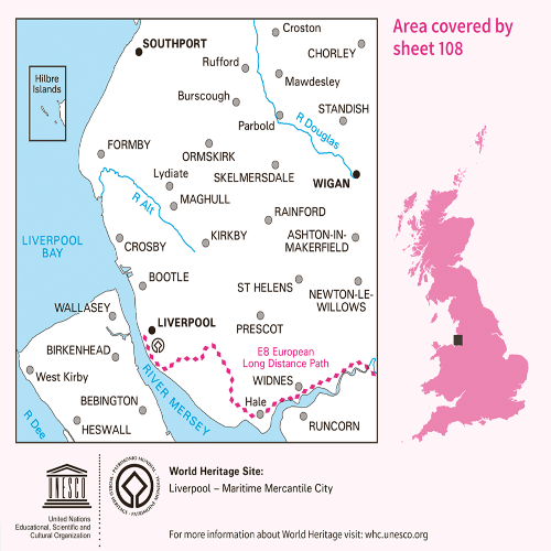
This series features 204 maps each covering 40km x 40km (25 miles x 25 miles)
Couldn't load pickup availability
Pickup available at Hero-Era All Shipping
Usually ready in 5+ daysPairs well with
OS Landranger - 108 - Liverpool, Southport & Wigan
If you have any questions, you are always welcome to contact us. We'll get back to you as soon as possible, within 24 hours on weekdays.
-
Shipping Information
Use this text to answer questions in as much detail as possible for your customers.
-
Customer Support
Use this text to answer questions in as much detail as possible for your customers.
-
FAQ’s
Use this text to answer questions in as much detail as possible for your customers.
-
Contact Us
Use this text to answer questions in as much detail as possible for your customers.

HERO-ERA Store
Our mission is to provide a one stop shop platform for classic wear and historic motoring that is friendly, professional and delivers real value. Together with our Members and Partners, we continue to build on our past efforts with the same shared enthusiasm and passion.
FAQs
Please read our FAQs page to find out more.
How can I contact your customer support?
You can reach us via our contact form, by email at [your email], or by phone at [your number].
How can I track my order?
Once your order has been shipped, you will receive an email with a tracking number. You can also track your order in your customer account.
Can I cancel or modify my order?
If your order has not yet been shipped, you can modify or cancel it by contacting us as soon as possible.
How can I return a product?
You have [X] days after receiving your order to return an item. Contact us to obtain a return label and follow the instructions on our "Returns" page.
Are my payments secure?
Yes, all payments made on our website are secured using SSL encryption and secure payment protocols. We do not store any banking information and work with trusted payment providers to ensure the protection of your transactions.